Hiking Bell Rock in Sedona, Arizona, was an impromptu decision while waiting to check in at our hotel.
It was about 3 p.m. on a Friday in September when we arrived in Coconino National Forest from Prescott, Arizona, via Highway 179.
The drive from Prescott took a little over an hour while driving from Phoenix requires about two hours.
After stopping by the Hilton Sedona Resort at Bell Rock in the Village of Oak Creek and confirming our room wasn’t ready, we drove a few minutes further north.
Bell Rock Trailheads and Parking
There are two trailheads for hiking Bell Rock:
- Bell Rock Trailhead North, closer to Sedona.
- Bell Rock Trailhead South, closer to the Village of Oak Creek.
Each has a small parking area and is accessible from Highway 179. The northern trailhead and parking lot can be found by searching for Courthouse Vista on Google Maps.
For the shortest walk with direct access to Bell Rock, pull into the Courthouse Vista parking lot; the Bell Rock Access Trail will get you there.
Unless you arrive early in the morning, you’re taking your chances on getting a parking spot.
The spaces are often full; however, as some visitors only stop for a quick photo (not a hike), the turnover can be higher here than at other lots.
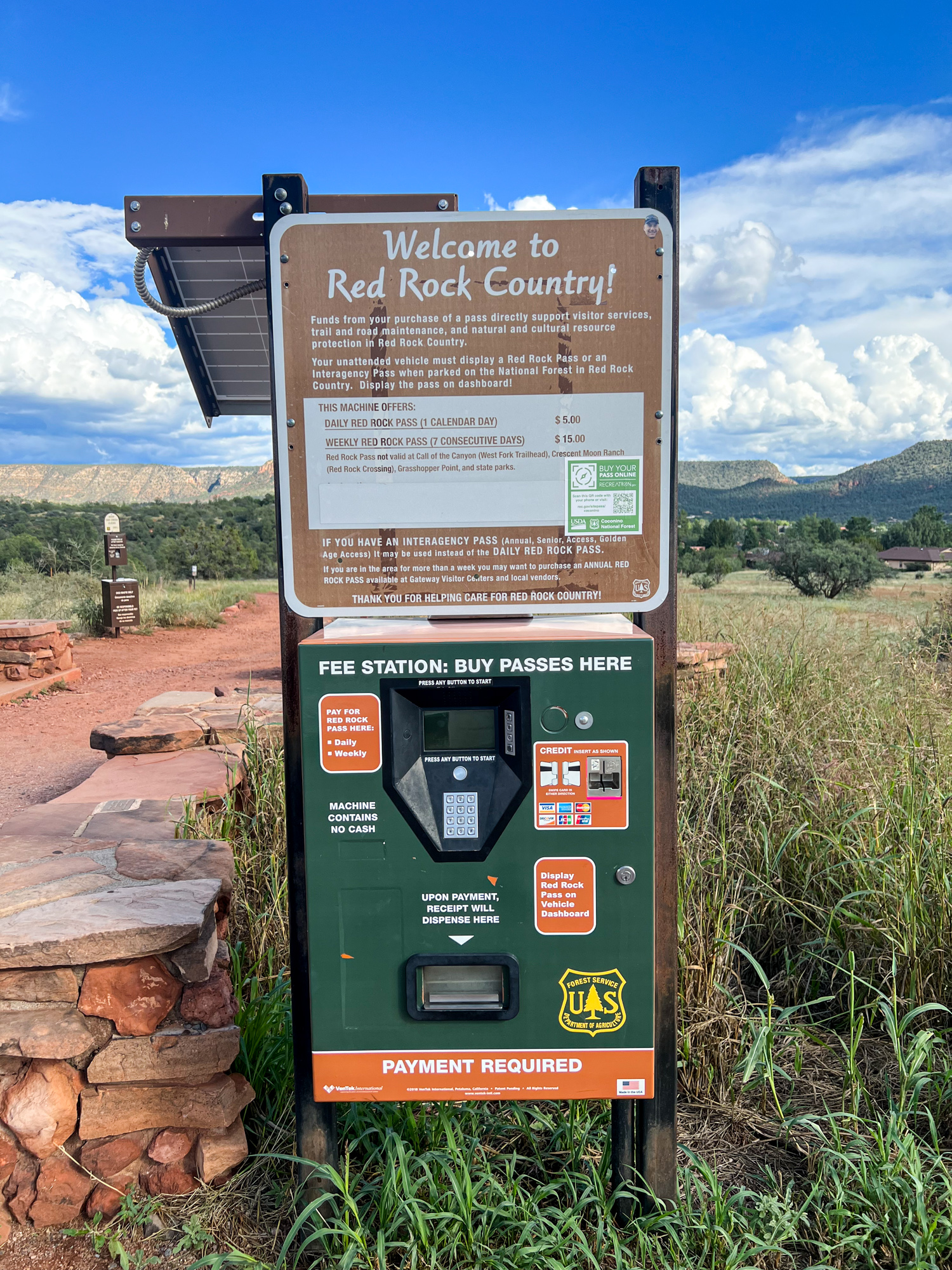
Buying a Parking Pass
Since Bell Rock was our first hike of my birthday weekend in Sedona, I used a credit card to buy the $15 weekly Red Rock Pass to display on the dashboard of our rental car.
Purchasing a pass is a requirement; otherwise, you risk getting ticketed. A daily pass is $5.
Kel used the bathroom facilities to change clothes and shoes while I began putting on sunscreen.
Even though it was now 3:30 p.m. and partly cloudy, there was no shade on the Bell Rock Trail, and I didn’t know how long we’d be gone.
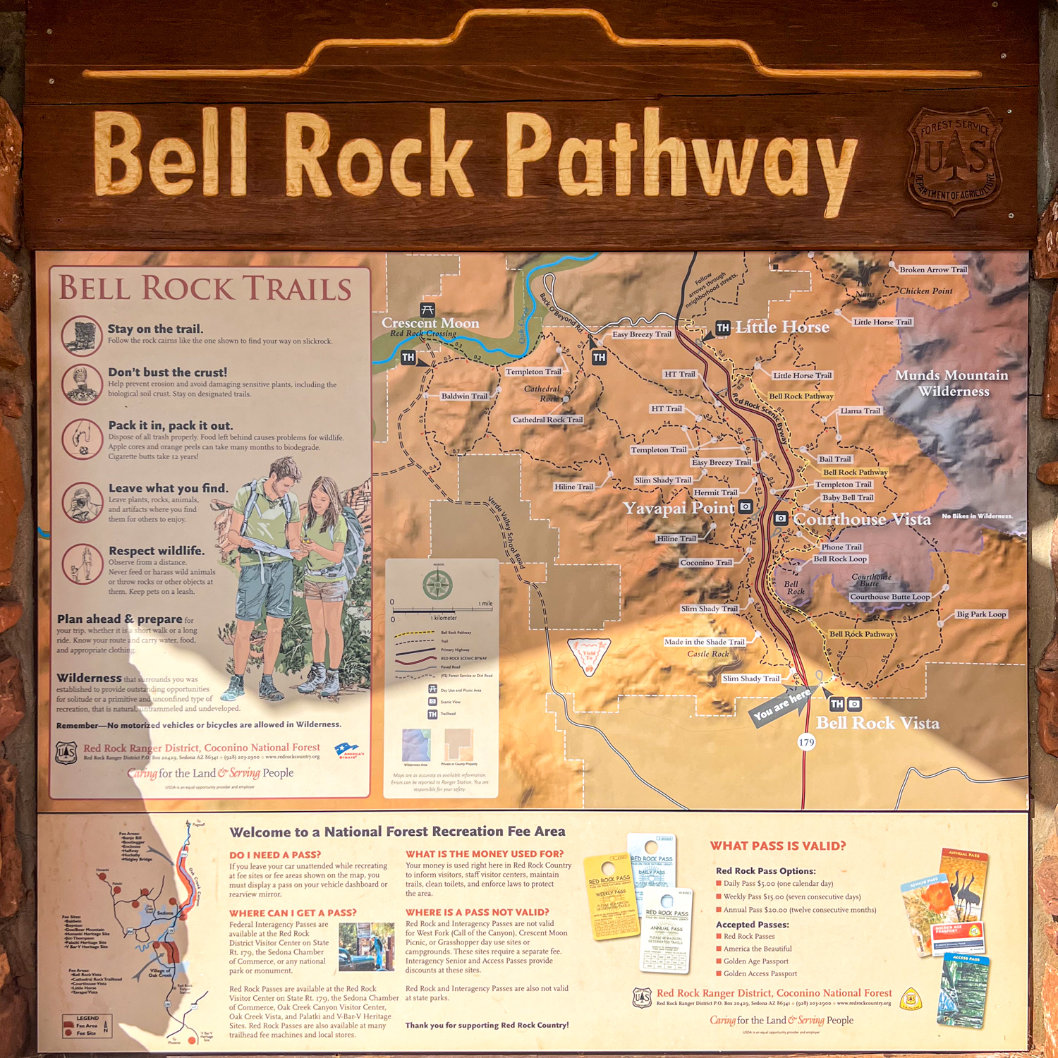
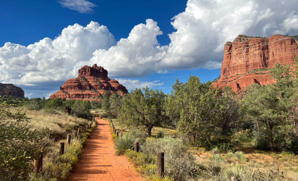
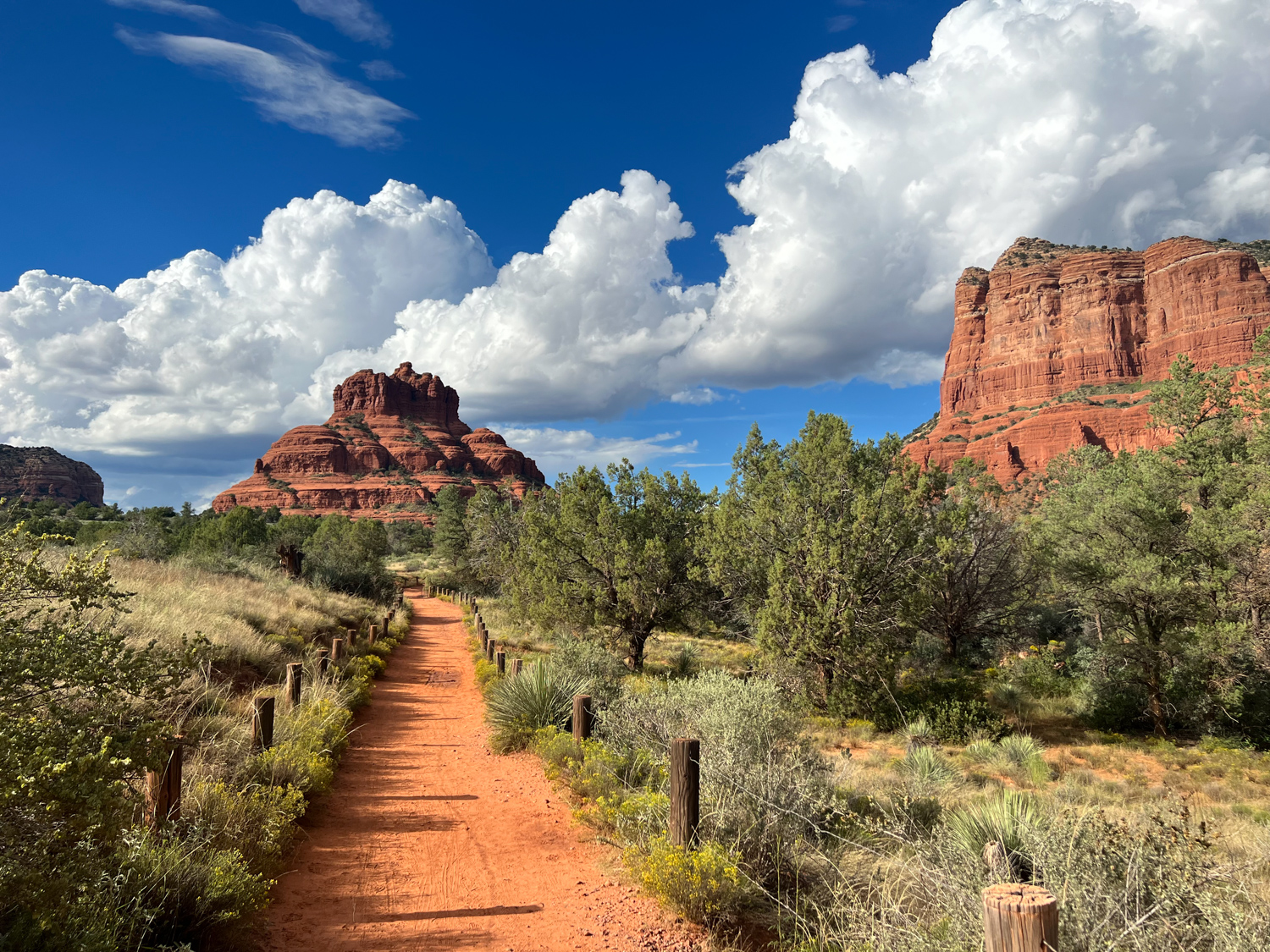
Before we began hiking, we got our bearings from a park map. A lot is going on amid the red rocks here, so allow me to break it down.
If you’re approaching Bell Rock from the south trailhead and parking lot, you’re starting on the Bell Rock Pathway, a 3.6-mile trail that runs north-south parallel to Highway 179; it’ll take you past the base of Bell Rock.
From Bell Rock Pathway, you can do the Bell Rock climb via the one-mile Bell Rock Loop Trail.
The climb has an elevation gain of about 700 feet. However, only experienced climbers should attempt to…
Click Here to Read the Full Original Article at GoBackpacking…