Within months of the Pearl Harbor bombing on Dec. 7, 1941, the United States, in cooperation with the Canadian authorities, set out to build a highway from British Columbia to Alaska, then a territory and viewed as vulnerable to attack by Japan. The original 1,685-mile road took more than 10,000 soldiers less than nine months to complete.
An upgraded version opened in 1948 and has been continually resurfaced and rerouted; It now measures just shy of 1,400 miles from Dawson Creek, British Columbia, to Delta Junction in Alaska, according to “The Milepost,” a guidebook to the drive.
The highway formed the heart of a family road trip I took last September from Alaska to Idaho, passing through the Yukon, British Columbia and Alberta, in Canada, along the way.
Relying on Google Maps won’t get you far on this drive, where cellphone service is sparse. In preparation, my son found a 1972 road map of western Canada and eastern Alaska that has remained fairly accurate.
The route, which takes motorists through some of the most stunning landscapes in North America, lends itself to a budget trip. We spent about $300 on fuel for the whole trip in a medium-size S.U.V. We often camped and ate picnic meals, starting in coastal Valdez, Alaska, where we overnighted on a 32-foot powerboat listed on Airbnb ($68 a night) with a great blue heron and a harbor seal as neighbors.
May and September, the start and end of the high-season months for traffic along this route, are also good times to see wildlife that is often pushed to lower elevations by snow.
Lessons in patience
From Valdez, we made our way to Wrangell-St. Elias National Park & Preserve (free), the largest U.S. national park, and then joined the Alaska Highway at Tok, a small town about 90 miles from the Canadian border that plays a large role in servicing sparsely populated eastern Alaska with its grocery stores, gas stations and restaurants.
We planned to drive deep into the Yukon on Day 1, but even with just 10 vehicles ahead at the border checkpoint, it took two hours to reach the lone agent, who asked us a few questions — mostly concerning firearms and hunting — and sent us on our way.
It was the first slowdown of many caused by stretches of unsealed road, construction detours and spots where the blacktop had pitched above frozen ground.
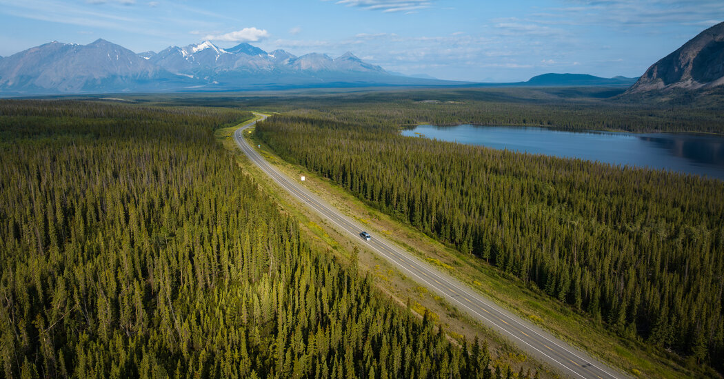
Yukon wilderness
Nearly 600 miles of the Alaska Highway traverse the Yukon.
From the border, the road travels southeast, passing yawning valleys with snaking streams and long…
Click Here to Read the Full Original Article at NYT > Travel…